Saturday, August 17, 2013

Day 7 (July 9th) Michigan Creek to Pachena Bay/Bamfield (12 km) 4.5 hours


It was around 4:30am when I heard hikers around us getting up. I am not really sure how much I actually slept on any of the six nights of the trip. I am a very light sleeper.  When the tide was coming in, the waves sometimes sounded like thunder crashing onto the shore. I would just lay on my matt thinking and hoping my body would rest if my mind didn’t.  
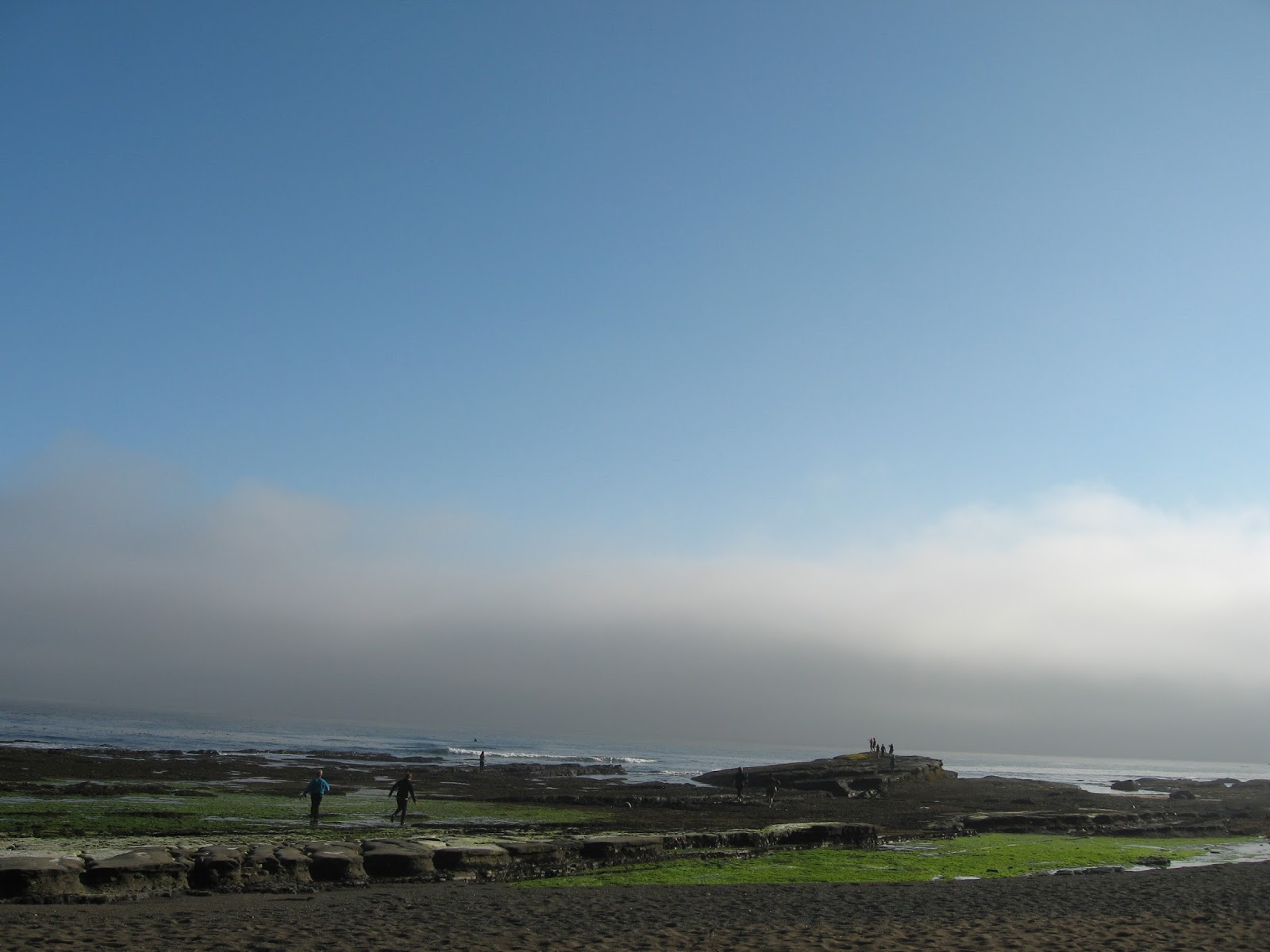
It was a foggy morning when we started out and my cough was at its worst with the heavy air. We were counting down the kilometres, bridges and ladders as we went by.  The path was flatter, smoother, and somewhat easier, but my body was tired. First it was my right knee that started to hurt, then it was my left ankle, then my left knee. I started to feel like I had sprained or strained both my ankles and knees.  My whole body ached as I forced myself to walk forward. We stopped at the Pachena point lighthouse almost hidden in the fog. Then later we went a lookout to watch a group of sea lions fighting and groaning on some rocks. I kept looking at my watch wondering how we were doing for time. We only took a couple of breaks. For the last leg of the hike I got to decide whether we should finish the trail on the beach or 
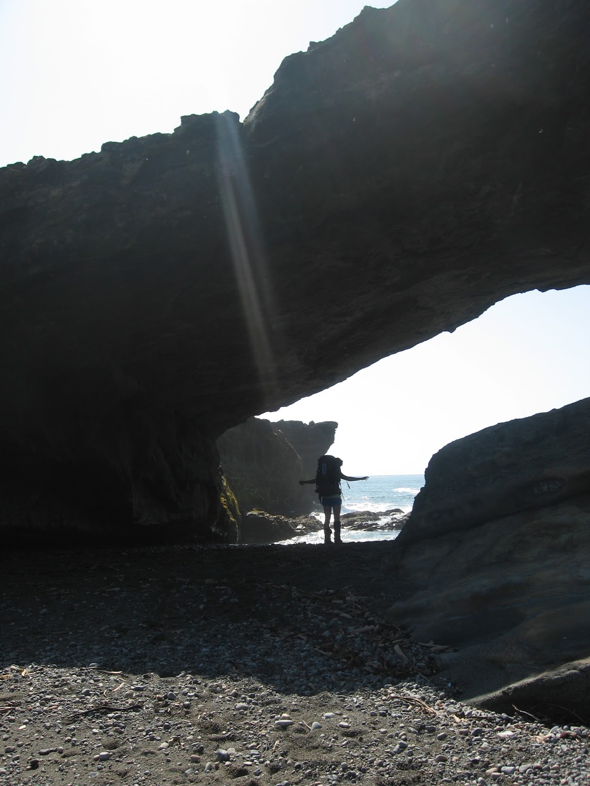
the forest. I chose the beach because my joints wanted something flatter.  Pachena Bay has one of the most beautiful beaches of the trail. There were a few rocks to hike over, but it was mostly sand. When the beach ended, we went through a few trees and there was the Parks Canada building. We were done.
It was around noon when we handed back our registration papers. We had to figure out where we were going next.  We went to join the group waiting for the bus at the parking lot. I was excited to take the smelly garbage bag out of my pack and put it in the bin.  There were a lot of people waiting. The other option we had had was to take a water taxi along the coast of the trail, but we needed to be at least a group of four and my sisters were concerned about the extra cost.  As well, we had needed to have reserved that in advance. It would have left around 12:15pm. Because it was a Tuesday there was also a ferry option going up to Port Alberni, but it was leaving from a dock in Bamfield around 12:30pm.   We waited for the bus. It was late and those that had arrived earlier had time to phone and make a reservation or had booked it in advance.  There were six of us waiting our chances. The driver told us there were three spots left on the bus. He listened to our stories and picked the other three. 
We went back to the trailhead office and pay phone.  At that moment, the German group that had traveled with us arrived. We got them to take our photo. Other people were arriving for the afternoon orientation and asked us what it was like. Sometimes you didn’t know what to say because they were so enthusiastic. There were two campground options: the beach at the trailhead or in the town of Bamfield.  We decided to opt to explore Bamfield. It was a 5km walk into town.  We started walking and then a pick-up truck drove up and asked if we wanted a ride.  Before Maggie knew it was the German group, she said ‘yes.’ Suddenly we were hitchhikers and sitting in the back of a truck.
Bamfield is a small town. The campground almost made me cry. After the beauty of the ocean, it was hard to set-up the tent next to RVs on some grass next to a road. The nice part was the running water and being able to wash my hands. Because we didn’t have a car to store our food, we had to do a bear hang on a beam in the food hut. After we had set-up, we decided to walk around the town. It was nice not to have to carry our back packs anymore.

Sunday, August 11, 2013

Day 6 (July 8th) Tsusiat Falls to Michigan Creek (13 km) 8 hours

Just as we were about to go to bed the night before, we saw the group of girls beside us moving their tents.  One of the girls from the Polish volleyball team came over to explain that they thought they were too close to the tideline, so we followed suit. In the morning we saw wet sand just next to where our tent had been. 

To start the day we had a series of ladders to climb to get back onto the forest trail at the top of the falls and then we were on our way to Klanawa River.  Up until this point

we had just waded across the creeks, but at this river we were going to take the cable car. There was a small metal car that fit two people with their packs. It had a cable pulley system to take you over the water.  Lisa and I got in and our weight took us about halfway across. Just as we started to pull, a German man named Johanus from the group ahead us came running out of the forest to help pull on the cable. He spoke little English, but he was always helping others out.  

Every morning as we hiked, a dozen or so hikers would pass us heading the opposite direction.  This morning we crossed paths with some trail runners. The idea to me is almost unthinkable, but some extreme sport lovers run the 75 km trail in one day. I overheard them explaining that it would take about 14 hours.  We had planned seven days and we were carrying heavier packs.

When we arrived at our last campsite, the teenage girls from the family next to us explained they had just seen a bear.  They had been collecting small pieces of driftwood to build a fire and a yearling had come towards them. It was a curious young bear, so they had to throw rocks at it to scare it. I was confused because in my bear reading it always said to back away and not to make eye contact. I guess it depends on the animal’s reaction. 

It was a day for wildlife siting because just after we had supper on the beach, a whale swam by close to the shore. A group of hikers gathered on a rock near the water to catch glimpses of the large mammal’s body appear above the waves. Once we saw a fin and a couple of times a spray of water. There were beautiful colours as the sun lit up the beach. 

It was the last night, but again I was worried about the hike the next day.  It was only a distance of 12 km, but the one bus out of Pachena Bay left at 12:30pm. We didn’t have a reservation for the trip, but I knew my sisters would like to be on it. I told them I didn’t want the pressure of having to hike quickly. We agreed we could stay in the town of Bamfield, but I still felt like I should try to make the bus. 

Sunday, July 28, 2013

Day 5 (July 7) Cribbs Creek to Tsusiat Falls (17 km) 9 hours


The challenge today was that we had to go a longer distance to reach the next campsite.  There was a no camping zone due of high wildlife activity, and we would be crossing through three Indian reserves.  For the first part of the morning we were on the beach and then going through the reserves we were on boardwalks in the forest. I walked cautiously on the soft planks and over the gaps with missing boards. We had heard about two recent evacuations in the area on the old boardwalk. One person had sprained their ankle on and another had gotten a nail through their foot. 
 
About midday we met up with others at the ferry dock by the Nitinat Narrows.  A couple was selling fresh halibut, salmon and crab legs.  Again it was similar prices $25 a plate, but I ordered some crab legs. I soon regretted the order because there were a lot of people waiting and a lively puppy that scared me because it kept jumping up on people and biting their hands. I felt the more time we spent there, the more time I would have to push myself to walk faster. I was really starting to develop a complex about being slow. I either trailed behind my sisters or walked in front with the two of them right at my heels. Maggie suggested when you were the leader you felt more hopeful and maybe she thought it would get me to walk faster. Even though we had eaten some of our food, the backpack didn’t necessarily feel any lighter.

At the ferry dock you could watch the crab being pulled out of cage and the aboriginal man would rip the top of crab off, break it in two, throw the pieces of crab meat to fish and put the legs in a pail. Next he brought them back to the kitchen and once steamed they would be brought out on a plate. By then I had also realized it was not a dish that was quick to eat. I was grateful that Lisa decided to help me pull it apart and eat it. It did taste good and I felt embarrassed at my impatience. Everyone was seeing me at my worst.  I knew the ferry was a possible exit point on the trail and I had thought about taking it.

It was a short ferry ride across and I felt a little better having had a longer break at lunch. We were on the forest trail for a while and then on to a beautiful beach walk.  Luckily the tide was low when we reached Tsusiat point and we could walk through the hole in the rocks.  A short ways later we were at the falls. There were lots of tents set up all along the beach.  Every night at the campsites there were groups of 40 hikers or so that would gather coming from both directions. 
After the tent was up, we went for a short swim and shower under the falls.  It was a refreshing experience. Even when we got to a campsite it still seemed rushed because we had to set-up the tent, set-up the beds, cook the supper, wash the dishes, get water (pump and treat with chlorine drops), take all food and ‘smellies’ out of your bag for the bear locker/hang and make sure you were ready for the next day. Sometimes I wondered how this was a “vacation.”

Friday, July 26, 2013

Day 4 (July 6) Walbran Creek to Cribbs Creek (11km) 6.5 hours


As we were getting ready to go, I overheard a woman who had started in the North saying her calves were sore from having spent the day walking on sand on the beach. I thought I will take sand over mud right now. 

The first thing we had to do was cross Walbran Creek. I switched into my sandals and walked through calf deep water at the mouth of the creek.  As soon as I got across Maggie told me I should have taken side steps to go through water in case the current took out one leg while I was crossing.  Next time I guess, but I had undone my back pack straps in case I needed to take it off quickly.  On the other side it was back on with the boots and gaiters – this time the gaiters were supposed to help prevent sand from getting into our boots. With the tide low we tried to walk on the hard packed sand or sandstone, but you still had to watch your step. There were lots of pockets filed with water. In the holes you could see little crabs, anenomes and sea plants. It was interesting, but I had to try to walk fast to not be too far behind. We had a short break at Bonilla waterfalls and it looked to be a nice campsite.  Eventually we came to a long stretch of sand on Carmanagh beach and another creek crossing. This time the water was deeper because the tide was coming in.  Watching others I saw that I would get wet all the way to top of my thighs, so following another’s example I decided to carry my pants across to keep them dry.

A short way down the beach was a group of large tents and inside was the popular restaurant/store called ‘Chez Monique.’ It was a taste of fresh food at high price. I had thought about getting a fish burger, but it wasn’t really worth $25 to me.  There were also some hiker ‘share’ boxes on a table where you could take or leave extra dried food or personal items you didn’t want to carry.  My sister picked up some sunscreen.


At the end of the beach there was a trail up to the light house. We told that we were welcome to visit grounds, but not to peer in the windows.  There was a bulletin board at the entrance with wildlife reminders, FAQ about the lighthouse keeper and a photo of a man in a labyrinth.  You sort of felt like a trespasser entering the yard and I didn’t know what to think about the two labyrinth designs cut into the grass. An older man walked by with a backpack. I thought maybe he was another hiker, but his backpack was a little small.  The young couple from Toronto was there with us and they talked to him. I guess he was the lighthouse keeper and when they asked about the weather he said we would have absolutely have no rain for the rest of the trip, but a little fog.  It was strange for a forecast, but stranger yet was that no sooner had we left the light house grounds was that a thick fog came down. For the rest of the hike that day the bright sun disappeared and we were in a big cloud. I thought it might be hard to find the campsite, but there was a giant cluster of buoys when we arrived. Al was there carving his name into one of them his son had left last summer.

Thursday, July 25, 2013

Day 3 (July 5) Camper Bay to Walbran Creek (10km) 8.5 hours


Last night as I lay in the tent listening to the waves and outside conversations I heard someone say the trail is 30% physical and 70% mental.  My first thought was to disagree with the percentages. To me, I felt it was a greater physical challenge, but I was definitely struggling with the mental part.  I can see how the more mud you go through, the more it makes you feel tired and frustrated. I had to find a way to have a more positive attitude.
I got up around 6:00am because not only was I slow hiking, but I was slow at getting ready in the mornings too. I could be a little faster if I slept with my clothes under my pillow and put on my boots and gaiters right when I was exiting the tent. I still had to learn how to work the dragon fly stove. Maggie was almost finished cooking breakfast by the time I was ready.  It took a little bit of extra time to prepare, but our buckwheat (gluten-free) and chocolate chip pancakes were very tasty. Some of the other campers were calling us the ‘gourmet girls.’
In addition to the mud and tree roots, we had extra challenges on the trail today that included a series of long ladders taking us up and down three creek ‘canyons’ and a suspension bridge. Sometimes I felt like I was on a giant obstacle course for adults. I was developing a skill to almost intuitively find small logs, rocks, roots, etc. to step on in the muddy sections of the trail. There was one time I thought instead of stepping around the mud I could crawl or slither under a fallen log. Instead I got stuck on my stomach looking as though the tree had fallen on top of me. In hind sight I should have taken off my pack first, because the weight of it made slithering next to impossible. However, it seemed to lighten the mood which was needed at the time. 
When we had reached the first set of ladders, we saw a guy go by wearing toe shoes. They looked a little worse for wear, patched with duct tape, but the wearer was still happy to have them on his feet.   At the bottom of the series of ladders we ran into our older friend Bob from the first day.  He was resting and said he felt dizzy. We didn’t see him later on that day at the next camp site, so I think he was evacuated from the trail. It was a little sad because we were so close to the turning point where the trail would become a little less challenging.  
Around km 57 we found ourselves in this kind of clearing. It seemed drier and sunnier. There was a lot of boardwalk and waist high bonsai trees. Unexpectantly, it was there we ran into the ‘thigh deep mud’. Maggie was in the lead and she tried stepping on some slanted boardwalk. Suddenly she slipped off the edge and went deep into the mud. She was quick to get out, but had mud everywhere. I guess there were some good things about being at the back.  When we finally got to Walbran Creek, we found ourselves on sandy beach.

Saturday, July 20, 2013

Day 2 (July 4th) Thrasher Cove to Camper Bay (8km) 7hrs

We woke up at 5:00 a.m., ate, packed up camp and started hiking by 6:00 a.m. I had agreed to take the beach path that we had been warned was for experienced hikers only. My sister really wanted to go along the beach and I wasn't sure I could make it up the steep incline we had come down to return to the forest trail.  I was worried because we had been specifically told in the orientation not to take that route because high tide was too early in the morning and at that point I did not feel like an experienced hiker.

When we got up that morning, I went to see Al, the oldest of the group at age 72, who completing his 7th hike. I wanted to know at what time he thought the tide would be too high to cross Owen Point. On the map it said that the point is impassable when tides are above 6 feet. My tide table said low tide (2.3 ft) was at 5:20am and high tide (8.9 ft) was at 11:40am. Al told me he thought it would be around 9:30 am. We had to travel 2 km to get to Owen Point and I was going to carefully watch the time. In the city 2km does not seem far to walk. I have the idea that I can walk 5km in an hour, but the day before it had taken about one hour to go one kilometre.

Al did not encourage us to take the beach path, but he said it was best to think about the boulders as a puzzle. We hiked stepping from one rock to another. I am not really sure if it is easier to step on smaller rocks or bigger boulders, but they were all wet and slippery with algae and seaweed. Because of the big back packs, I felt like my balance was off. As we got started I found the I could use big pieces of driftwood as a sort of railing and when I didn't know where to step next I would sit down and slide on my bum. When there was a small stretch of sand I would take a sip of water as I walked. After a couple of hours I felt like I was basically crawling and rolling myself between the cracks in the rocks. We had gone too far to turn back and I started to cry again. I told my sisters I never ever wanted to go on a hiking trip with them again and I was only there because I felt obliged to be. They were very nice to me and Maggie said obligation was not going to get me through it. I felt like I said more than I should have, but sometimes once you get started it's hard to stop. We had to keep going and to be honest at that moment fear of the incoming tide was my biggest motivator. I saw Lisa slip on some rocks ahead of me. She said she was fine, probably just another bruise and a scare, but we were in a dangerous situation. As we hiked, I started to look for places we could go to wait out the high tide. It was pretty much cliff and there didn't look like many options. We saw an island of trees and Lisa thought that was Owen Point, but it turned out it wasn't.

There was a third group that was hiking the beach trail that morning. A group of 18 year old track athletes from Edmonton. Maggie, my sister who is nine years younger than me thought of them as young. They had passed us about the time I was crying. One of the guys from that group came running back towards us. He said Al was up ahead waiting for us and there was a surge channel that was almost too deep to cross already. It was almost 9:00 a.m. and somehow we started to run. We passed some caves in the sandstone, waded through some calf deep water and were pulled up onto a slippery rock ledge. I was astonished that we made it and very grateful for having been rescued. Maggie scraped her knee while climbing on to the ledge, but seemed unaffected. It was so nice to walk on the solid sandstone ledge and interesting to look in the moon like craters or pockets to see anemone, crabs and seaweed. I started to feel better.

We walked on the ledge for a while crossing some surge channels and then reached a cluster of buoys in the trees marking the path up to the forest trail. After a snack we headed up to the next challenge of mud holes old board walks and more mud. Finally around 2:00pm we had reached the next campsite. Maggie wanted to keep going because we had only covered 8 km and we only had five more days to do the next 62 km. I said my body was too sore to do 4 more km to the next campsite and reluctantly she agreed to stay.

Thursday, July 18, 2013

Day 1 (July 3rd) Victoria to the Gordon River trailhead and then to Thrasher's Cove (5 +1km)
The taxi came at 5:25am. I wasn't quite ready, but we rushed out the door. My youngest sister's Maggie's friends Meghan and Sameen had hosted us in their apartment in Victoria. It was fun to take in the Canada Day celebrations and see some friends while in the city. We took part in the living Canada flag photo in front of the Legislature on July 1st.

At 6:15 am eight of us got into the West Coast Trail Express at the bus station station in Victoria. The bus rattled off on a windy road along the coast and through the forest. My lower back was already sore from lifting the pack. I tried to think positive. It wasn't raining and I was lucky to have this opportunity.
At the trailhead a woman from Parks Canada showed us a PowerPoint presentation and talked about some of the things we would see along the way. It was a lot to take in. Next, I went to the washroom in the campground next door then we put on our packs and got on the ferry to take us across Gordon River. Just as we were starting, some hikers were finishing and they joked about the 'smell' of soap when they saw us. From the very start it was a difficult trail. It was a steep uphill climb with lots of tree roots, fallen logs, and mud. I started crying after about 0.5 km and just before finishing the first kilometer we stopped to have lunch. We had started at about 11:15 a.m. and every 30 or 50 minutes we stopped for a short break for water and stretching. We were the last of the group that took part in the 9:30 a.m. orientation. An older man Bob was hiking on his own and kept a similar pace as us. He gave me tips like to hang my hiking sticks over my wrists while going up and down the ladders. I was walking slower and slower on the sharp descent to Thrasher's Cove the first campsite. It took us about 5.5 hours to do the first five kilometers of the trail. The campsite was about 1 km off the trail. We found a spot on the beach next to the driftwood that looked to be safely away from the reach of the high tide. Maggie wanted to do the challenging beach hike in the morning, so we would need to get up really early to be able to cross at low tide.